Sunday, June 28, 2015

Flight from Lincolnton, NC to Marcellus, NY

Weather always makes flying more interesting!

After a short but great visit with family in Iron Station, NC that included an afternoon in the pool and watching my nephew Nate play an evening ball game in Charlotte it was time to head back.

Remember that cold front that we flew in behind two days ago? Well, its story didn't end there. After stalling out over South Carolina it backed up a bit and sat with its associated low pressure over Virginia. An area of showers and thunderstorms were waiting patiently for us to make our return flight. It was to the west of our flight path and there was plenty of room to head east if necessary. The Prog charts showed scattered showers in the morning along our route with clearing midday and more numerous showers again later in the day. We had a good window, or so we thought...


After saying 'good day' to Charlotte ATC we climbed a 3,500 foot cruise and relaxed for the 2+ hour flight north to Virginia. 

It wasn't too long before it was obvious that this area of storms was moving much faster than forecast. Radar updates every 10 minutes on Garmin Pilot app showed it moving across our planned path from Statesville to Shenandoah. Diverting further to the east it became a race to round the corner ahead of the storms to then turn north again. Going 100 mph would seem fast in a Walmart parking lot, but in the sky with large distances to cover and trying to outrun storms crossing your path that move at 40+ mph it feels like you are just sitting there!

Nope, not flying under that.

Rounding the mark and turning north

Staying to the east of this area of storms that covered more than 100 miles and turning north we still had options to the east and south. However rounding the corner I was feeling like our options were narrowing. We could take a chance of beating this before it cut us off near Washington. Going further east along the Atlantic coast was another option but many of the airports along the way were still socked in and apparently not clearing up as forecast. I wasn't happy with the way things were going. Time to land at Danville Regional about 10 miles to the southeast of me and sort this out from the safety of the pilots lounge.

I immediately turned southeast and began descending. Dipping below a scattered layer at 800' we entered the pattern and I announced downwind on runway 02. As I announced turning base the radio screen went blank and reset to its base frequency. I quickly re-tuned it to unicom just in time to hear a Piper announce he was on a 2-1/2 mile final to land on 02. I rolled back onto a downwind and watched the Piper on final and then turned to follow him in. Hand held radio will be used to broadcast for the rest of the flight...

On the ground we were met by the "Follow me" golf cart which guided us to a tie-down. Before we were out of the plane the attendant had us attached to the earth and as we climbed into the cart it started raining.

The storms stayed to the north of the airfield with only a brief light shower. We waited inside along with other pilots watching the news on one TV and radar on another.

After almost 2 hours the storms seemed to be fizzling out and moving east. Discussing the weather with a third pilot of a TBM, the pilot of the Piper Comanche decided going west around the remaining weather would be the best route to his destination in Canada. I decided to head north towards Shenendoah Regional as the weather was improving there. Once there we had a clear run northeast to home.

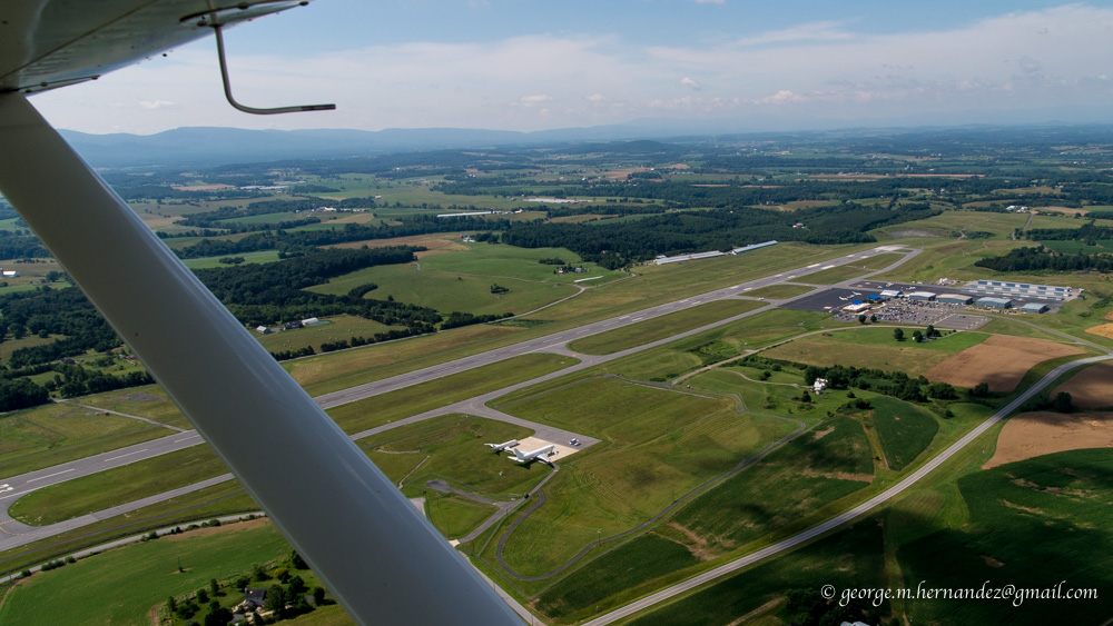
We made it as far as Lynchburg, VA about 50 miles to the north where we would stop for fuel giving us full tanks and thus more options as we headed into the questionable weather ahead.

Lynchburg, VA


Falwell Airport

With the aircraft radio only good for listening, I had to plug into the hand-held radio for transmitting. Rather than landing the towered Lynchburg airport I decided to land at Falwell Airport about 5 miles to the northeast. I'm so glad we did! Approaching this airport I could see there was a little rise on the western half of the runway. It wasn't until turning final that it became apparent that it wasn't a little rise, it looked like we were landing on an Olympic Ski Jump. 
Runway 28 end elevation is 801 feet while runway 10 end elevation 938!

We fueled up, drank water and ate some grapes. Taxiing uphill to runway 10 for a downhill take-off  it took cruise power to do 10 mph up the hill! On take-off we left the ground just as we started downhill.

Leaving Falwell we initially started towards Petersburg, WV. 
Flying on top I kept a close eye on the Petersburg weather. When we started it was scattered clouds with a high overcast, when the next update came along the lower layer had changed to broken. Though this probably was only temporary condition I wasn't going to risk being stuck on top of the clouds over mountainous terrain. (Where the mountains were in the clouds)


We headed back 20 miles to Lynchburg with the intention of landing at the larger airport, possibly spending the night in town. But once under the clouds we explored north through the valleys and worked our way to just southeast of Shenandoah Regional which now was partly cloudy. Only one mountain range separated us from sunshine and home. Where route 64 crosses the ridge we could see a gap where there was some space between the clouds and the earth. Cautiously approaching, leaving options to turn back, we could see sunshine through the pass and through it we went.

By this time it was getting late in the afternoon. One of my goals of this trip was to visit my good friend and fellow pilot Jeff who lives in Staunton, VA. It wasn't going to happen. At this point after a short rest we would arrive back home after 7 PM. The next day, Saturday, rain and poor flying conditions was forecasted. Otherwise I would have like to stay the night in Va so we could visit. After calling Jeff, I decided that another trip to VA before the end of the season would have to be made.

Back in the air headed for Mifflin with all the weather behind us now it is just easy cruising.

Garmin Pilot running on my Android phone

Back in familiar territory with Cayuga and Seneca Lakes below.

Next, one of my favorite parts of a flight, a long descent at cruise power to my home field for a landing at 7:41 pm.

Total flight time round trip: 13:36 minutes.


Thank you Diane and Jeff for a great visit!

Dad, I hope you enjoyed our little adventure...


Flight from Marcellus, NY to Lincolnton, NC

In an earlier post I stated, flying is always fun, but having a destination makes it even better.

Also, if a little is good, then more is better.

More in this case came to me last winter when I thought it would be fun for both of us if I flew my father down to visit my sister Diane and her family at their small farm in Iron Station, NC.

Dad is a pilot too, learning to fly at Camillus Airport back in the 60's and flying from there until it closed down sometime in the late 70's. Other than the X-C required as a student I don't think he ever ventured far from Central NY. I've made a few long flights ferrying airplanes for other owners. As a co-pilot, a coast to coast California-New York and several trips to Florida. This flight would be the longest in an aircraft I owned.

We make the drive to Iron Station about once a year. Taking RT 81 and RT 77 it is about 740 miles and 11 hr 40 min. Flying cuts the mileage to 583 and the time to 6 hours at a cruise speed of about 100 mph.

Originally we planned on leaving on Tuesday but a cold front was forecast to pass that morning. Monday was good as far as sky conditions, but south winds ahead of the front would have slowed our progress significantly. Behind the front, which would be leaving North Carolina as we took off, the winds veered to the northwest adding both a crosswind and a slight tailwind to our southwesterly flight.

With full fuel, two adults and about 25 pounds of luggage we would be heavy departing our little grass strip. This worried me. Leading up to the trip I considered leaving the tanks low and stopping to top off in Ithaca, but I was confident that with our early departure we would be off the ground before the northwest winds reached the surface. At 6 am the winds were calm and allowed us to take off to the southeast on runway 15 which is about 12 feel lower at the departure end and most importantly, with no trees. Loaded on a warm day we spend way too much time waiting to clear the treetops when going the other way.

In the cool morning air we were off in a reasonable distance and climbing steadily though not gaining altitude particularly fast. We probably could have gone the other way.


There was still quite a bit of moisture in Central New York and for the first 15 minutes until just before Cayuga Lake we were held to about 2,500 feet under a layer of stratus. After passing Taughannock Falls we climbed to 4,500 then 6,500 for the first leg to Mifflin, PA a little under 2 hours away.

Cayuga Lake and Ithaca beyond

With the smooth morning air and aircraft trimmed for level flight little input was needed for much of the flight. We could just relax and watch the world move slowly below us.

Everywhere clearings, drilling, waste water ponds for fracking. Thank God New York learned from the environmental disaster Pennsylvania experienced as a result of the unregulated fracking process.

Approaching Mifflin. The ridges which run all the way to Tennessee make this area a popular starting point for sailplanes on long distance flights.

The game: Calculate when to begin the descent to arrive at pattern altitude just as you arrive at the airport. A gentle on the ears, 250 foot per minute descent from 6,500' to a pattern altitude of 1,600' should be started about 20 minutes out. I wanted some extra altitude over these ridges and waited another 5 minutes or so to begin. Five minutes, plus the additional speed from a power on descent cut into 15 minutes thus and I ended up with a little extra altitude.

Fuel 10.1 gallons / 1.77 hrs = 5.7 gallons per hour @ ~2,450 rpm
Up until this point, dumping 5 gallon cans of auto fuel into the wings, I had never gotten an accurate measure on fuel consumption. My best guess was something a little over 6 gph in cruise. We landed with more than half our usable fuel. It was reassuring to know we hold about 4 hours at normal cruise, longer if we reduce power.

After refueling and a phone call to Charlotte ATC for the final OK to enter their Mode C airspace with an inoperative Mode C transponder we were off to our next stop at Shenandoah Regional in VA.

Entering the downwind leg for RWY 05 and Shenandoah Regional.

Another stop for fuel, again still more than half tanks but definitely time to stretch our legs and a snack of coffee cake Mom sent with us. Delicious! We also ran into a friend of mine Michael Godfrey fueling his Maule for a flight to the Delmar peninsula on a birding project. A brief visit and we were on our way.

Fuel 9.4 gal / 1.78 hours = 5.28 gph 
(What did I do differently? Maybe tanks not filled to 100%? Maybe better power from 100LL? Warmer, thinner air as we head south?)

Continuing south we cruised along in the smooth air on top of scattered cumulus clouds and increasing haze. 

Smith Mountain Reservoir

Shortly after passing Winston-Salem we began our descent towards Statesville, NC. Leaving our cool cruising altitude we arrived at the edge of the Mode C veil at 2,000 feet for the final 20 miles in a hot hazy and bumpy atmosphere to Lincolnton County Airport.  I contacted Charlotte Approach about 2 miles south of the Statesville airport but it wasn't until almost 11 miles later that they picked me up as a primary contact on their radar. 2,000 Feet above sea level is less than 1,000 above ground with some hills between us and the radar at Charlotte. As Lincolnton airport came into sight radar service was terminated, frequency change approved and we announced our approach to the pattern.


Lincolnton County


Nate, me, dad, Diane, Evelyn, Grace

Taxiing up to the ramp we could see my sister Diane and family waving from the terminal. 

Perfect!


(Next the return flight. Weather always makes things much more interesting!)


Sunday, June 7, 2015

Geneseo Fly-In Breakfast

No excuse or even a specific destination is needed to go flying, but having either of these does make it even more fun! Reviewing the list of upcoming events on upstatelist.org last week I found there was a pancake breakfast this Sunday at the Warbird Museum in Geneseo. This would be a fun place to bring my dad.

The weather was perfect for the flight light south winds at the surface and only a slight headwind for the flight out. Taking off a little after 8, the air was smooth as glass for the cruise west at 4,500 feet. 

Auburn and Owasco Lake beyond


Me and Dad

Cayuga Lake


Seneca Falls with Finger Lake Regional Airport beyond

Canandaigua Lake 

The breakfast was a bit quieter than I expected. Nowhere near the crowds at Weedsport's every other week breakfast and only a fraction of the attendance at the Marcellus Fathers Day breakfast (coming up in a couple weeks)

Dining area in main hangar

Enjoying breakfast

After eating we walked around the hangar and looked at a half dozen aircraft in various stages of rebuilding. We also toured the Warbird Museum.

Harvard

Scale P-51 (Stewart 51?)


I'll have to check out my reflection when no one with a camera is watching!

Beechcraft Super 18

DC-3 W7
This aircraft took part in the Invasion of Normandy


Pilot...Co-pilot...Hey! Where's mine?

W7 flew back to Europe to take part in the Return to Normandy ceremony last year.

Geneseo from the south

Montezuma Wildlife Refuge

Relaxing and enjoying the view

This guy flew into the window as I was taxiing out just a moment before I closed it for take-off. For the entire return flight it walked back and forth across the windscreen exiting the plane when I got out in Marcellus.

We had a nice flight and I was happy to have my dad along with me. 
(This flight was just a warm up for Dad and I when in two weeks we will take the Cessna to Charlotte, NC)