Showing posts with label cessna. Show all posts

Saturday, November 19, 2016

Flight to OK Slip Falls near Indian Lake

It's mid November and we have been blessed with warmer than normal fall weather. This pattern is about to be broken by a cold front arriving Saturday that already has snow warnings posted for the area.

Friday however, was a beautiful day. Heading to the airport late morning there were warm temperatures, clear skies, light surface winds and a very stable atmosphere. Planes were flying and the radio full of traffic. I think everyone realized we should make the most of this day.

Where to go? I considered heading down to the lower Hudson over the Catskill Mountains, but headwinds on the return would make for a long ride back and the days are now getting quite short. Winds of 15 kts aloft were forecast to be out of the west over western and central NY but turning sharply to blow from the north over the eastern half of the state.

I decided to go northeast towards the High Peaks to take a look at OK Slip Falls. CNY Hiking - OK Slip Falls. Previously located on private land this waterfall has only recently opened up to the public. It is one of the highest falls in the Adirondack park and has been on my list of places to hike, but haven't had a chance yet.

With the GPS coordinates of the falls entered into ForeFlight and after topping off the tanks I was in the air making a circling climb over the airport before heading east over the Syracuse Class C airspaces' 4,400 foot upper bounds. Until a couple months ago my transponder was out of service, so flying through or even over the Class C airspace was not permitted. I would always go under its upper layers or all the way around.


This gave me a rare look at Onondaga Lake and Hancock Airport. Even my workplace at the Syracuse GMF...
Onondaga Lake from the south at 5,500'

Carousel Mall

Syracuse Hancock International Airport

For all my Postal friends, the Syracuse GMF. 
(Sorry you guys had to work today...)

Oneida Lake

Cruising along in perfectly smooth, though not perfectly clear air, I settled back to relax for the hour or so it would take to reach my destination.

The engine rumbled alone happily until about 10 minutes later. Somewhere over the eastern portion of Oneida Lake while scanning the sky for traffic and enjoying the view, I was pulled out of my relaxed state of mind by a sudden and rapid decrease of engine RPM. Quickly looking at oil pressure, which was normal, I advanced the mixture to "full rich", turned on carburetor heat and turned towards the farmland south of the lake.

The engine returned to normal almost instantly. I continued in a gradual turn back towards home base  while checking to insure that it was simply carburetor icing. Eventually I turned back on course except now adding carburetor heat at regular intervals and there were no further problems. Engine issues over the farmland of Central New York is one thing, there are many, many fields to choose from. In the Adirondack Park there is only a choice of forest, wetlands or lakes. 

Griffiss

I thought this was interesting with both the old Griffiss airbase and the Erie canal in one view. Then I realized that the thruway and NY Central rail line was in the picture as well!

Hinkley Reservoir 

A few years back I kayaked around this lake with the CNY Kayak club.
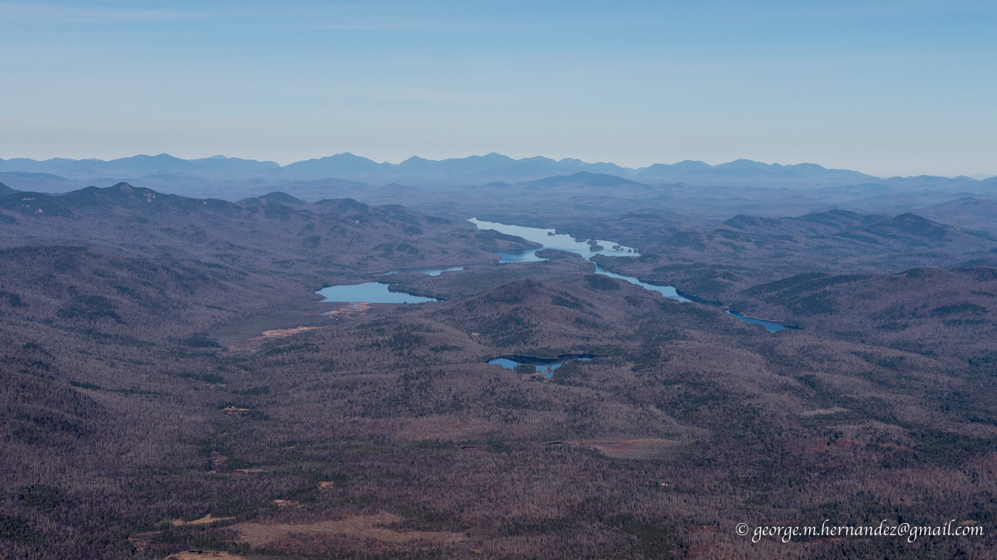
Indian Lake and the High Peaks beyond

Village of Indian Lake with Blue Mountain beyond. Blue Mountain is a great hike. At the top there is a fire tower that gives great views for many miles around.

OK Slip Falls

ForeFlight and my Bad Elf Pro GPS put me right over the falls! A few turns around for some pictures before heading back to Piseco 30 miles back to the southwest. Because of the unforgiving terrain below I stayed at a reasonable altitude. For a closer look I will hike in someday.

Mountains and haze

Heading back into the sun all the shades of blue as the mountains fade away into the hazy air looked worthy of a picture.

45U on the ramp at Piseco

That is a house in the background with a built-in hangar on the airport side


Piseco Airport

All the way back to Marcellus the sun and haze made picture taking near to impossible. The mostly clear air over the mountains where winds aloft were from the north contrasted sharply with the hazy air in the valleys brought in by western winds.

Great late season flight. Three hours round trip.

As I write this Saturday afternoon the cold front is already entering the area dropping temperatures from the 70's a few hours ago to 50 degrees at 4:00 pm. Rain and snow are following right behind.


Monday, January 25, 2016

Lake Ontario and ADS-B "in" with Raspberry Pi

Finally, an opportunity to try out my $100 ADS-B set-up in the air.

I'm using a Raspberry Pi and USB radio receiver to WiFi data to ForeFlight on my iPad. Though I have been able to see traffic while on the ground, weather can only be picked up once in the air.

I'm not sure how high I was when the signal was first received but leaving the pattern at 800' my screen indicated "1 tower". Even though most of the flight was below 3,000 there was always a signal from between 1 and 3 towers.

Originally, the plan was to fly north along the shore of Lake Ontario to the mouth of the St. Lawrence near Cape Vincent and photograph lighthouses and ice. But, skies remained overcast and hazy with the forecasted clearing today not arriving until after I had landed and put the plane away.

In spite of the clouds and haze, flying up to Ontario was worth it. Along the way I played a bit with the weather and traffic displayed on my tablet, and on Lake Ontario there were some interesting patterns in the ice.


My first look at traffic as I headed to the western corner of Oneida Lake. Here two aircraft are displayed to the east of Syracuse Hancock. One 200 feet above my altitude and another 2,100 feet above.


Zooming out a little later in the flight shows aircraft over Rochester and Utica. Touching an aircrafts' icon opens up a box with more information. Though most of the time I had airports displaying ceiling information, here airport temperatures are being displayed.

For now my unit is only receiving from aircraft transmitting on 978 MHz. Later this week I'll complete the picture and add a second receiver that will bring in 1090 MHz on which most airliners broadcast their information.


Oneida Lake with ice as far as I could see into the haze

A meandering creek near Port Ontario

Port Ontario and dark tannin water flowing into Ontario

Nine Mile Point power station

Ice drawn away from the shoreline by the south winds.

I couldn't get over the size of this repeating pattern made by eddies as ice carried by winds and current moved out into the lake from west of Oswego

Oswego

On the way back I found that tapping on an airport brings up its complete weather information

Onondaga Lake ( for my fellow Yacht Club members )


Marcellus airport and the town beyond.

Mike Murphy (who also belongs to OYC) departing in his Piper Tri-Pacer


Sunday, June 7, 2015

Geneseo Fly-In Breakfast

No excuse or even a specific destination is needed to go flying, but having either of these does make it even more fun! Reviewing the list of upcoming events on upstatelist.org last week I found there was a pancake breakfast this Sunday at the Warbird Museum in Geneseo. This would be a fun place to bring my dad.

The weather was perfect for the flight light south winds at the surface and only a slight headwind for the flight out. Taking off a little after 8, the air was smooth as glass for the cruise west at 4,500 feet. 

Auburn and Owasco Lake beyond


Me and Dad

Cayuga Lake


Seneca Falls with Finger Lake Regional Airport beyond

Canandaigua Lake 

The breakfast was a bit quieter than I expected. Nowhere near the crowds at Weedsport's every other week breakfast and only a fraction of the attendance at the Marcellus Fathers Day breakfast (coming up in a couple weeks)

Dining area in main hangar

Enjoying breakfast

After eating we walked around the hangar and looked at a half dozen aircraft in various stages of rebuilding. We also toured the Warbird Museum.

Harvard

Scale P-51 (Stewart 51?)


I'll have to check out my reflection when no one with a camera is watching!

Beechcraft Super 18

DC-3 W7
This aircraft took part in the Invasion of Normandy


Pilot...Co-pilot...Hey! Where's mine?

W7 flew back to Europe to take part in the Return to Normandy ceremony last year.

Geneseo from the south

Montezuma Wildlife Refuge

Relaxing and enjoying the view

This guy flew into the window as I was taxiing out just a moment before I closed it for take-off. For the entire return flight it walked back and forth across the windscreen exiting the plane when I got out in Marcellus.

We had a nice flight and I was happy to have my dad along with me. 
(This flight was just a warm up for Dad and I when in two weeks we will take the Cessna to Charlotte, NC)

Sunday, April 26, 2015

Williamson-Sodus and Oswego

It is late April and the first Sunday fly-in pancake breakfast is still weeks away. Looking for somewhere interesting to fly with my father I decide to head northwest to Williamson-Sodus, an active airport about 25 miles east of Rochester, NY along the shore of Lake Ontario. From there we could follow the shoreline east to Oswego before turning back south toward home.

Even with sunny skies, a northwest flow of Canadian air is keeping mid-day temperatures from rising past the upper 40s. This cool breeze also brought some bumps with good thermal activity south of the lake and a bit of a headwind to keep our groundspeed down on the outbound leg.

Apple's most recent update to iOS for my iPad carried with it a bug that prevents navigational software such as Garmin Pilot (which I use), Foreflight and others from using the GPS information from external sources. Since my new iPad mini 2 does not have a built-in GPS I have had to use my Android phone that contains a GPS and can also communicate with my Dual XGPS150. The plus side to this is that my phone stayed charged, I could see my panel around the smaller phone and weather radar and winds were visible on the map screen of Garmin Pilot through my data plan.

Garmin Pilot on a Samsung S4. Viewing the Navigation page. 

 One of the great things about flying along at only a couple thousand feet are all the interesting things that you come across. Look close, better yet, click on the image for a larger size.

From a distance the lake seemed to have a foggy look to it, as I got closer I realized it was a reflection of the cloud layer above rather than some low level atmospheric condition over the water. Departing Williamson a little later I found the atmosphere was clear enough to see the Canadian coastline across the lake.

As we returned to the plane after a cup of coffee, a gentleman pulled up in his car with a big smile and saying he has a 1964 Cessna 150. Ours is a '65. Both have 360 windows and a straight tail (the way God intended a 150 tail to be...) 
We talked about our planes and he took our picture.

Williamson-Sodus (SDC)

Chimney Bluffs just a few miles to the east.

Living on the edge!

Fair Haven Bay and the State Park on the left 

Looking east over Oswego

Fulton

Me and my Dad 
(And yes, I am aware I need to work on a better face for the camera!)