Showing posts with label cross country. Show all posts

Monday, May 2, 2016

Flight to Slatington PA and short hike on A.T.

A couple months back I was thinking ahead towards adventures to take when better weather arrived. Looking over  topographic maps of the Appalachian Trail I found an airport in Pennsylvania that was about a mile from a trailhead. It was at the Lehigh Water gap at the town of Slatington.

Originally the plan was to fly down then hike along the A.T. to a designated campsite where I would spend the night. The following day I would hike back and either fly home or spend the night in town. However on the dates I had planed for this and taken time off from work, a storm system with rain moved through the northeast.

This time with only the day to do it, this was a scaled back version of the original plan. Fly down, hike, and fly home.

I got an early start and was in the air about 7:30 am. The flight down was smooth in the morning air, but haze made photography difficult from my cruising altitude of 5,500 feet. There was a slight tailwind allowing me to get there in about 1:40.

From the left seat looking east over Binghamton, NY. Sunlight and haze. Returning home in the afternoon the sun would again be on my side looking west. Perhaps I should sit on the other side?

 Passing Sky Haven Airport. I would return to this field in the afternoon for fuel.


On the ground at Slatington Airport. The mechanic based on the field gave me a tour of the facilities and a ride across the runway to a campsite along the river. 

Walking along a rail-trail to the Lehigh Gap Nature Center (lgnc.org) and the trailhead for the Appalachian Trail several swallows perched on the fence allowed me to get quite close before taking to the air.

From the rail-trail on the way to the Nature Center. The Appalachian Trail crosses the river on this bridge then returns to the ridge top.


This area was once a Super-Fund site. Pollution from a Zinc smelting operation just downwind of the ridge resulted in toxic and acidic byproducts funneling through the gap killing plant life and leaving the area devoid of any life. Through the efforts of a conservation group considerable progress has been made in revegetating the area which will keep toxins from continuing to wash into the river or be ingested by the returning wildlife.


A view from the top across the gap

The zinc smelting operation in Palmerton

Slatington Airport and the Lehigh Gap

Returning home with 'maybe' enough fuel for the flight back, I stopped in at Sky Haven for about 10 gallons of 100LL. Watching fuel gauges approaching empty seems to take the fun out of flying...

Sky Haven had no fuel, but they did offer a car and gas cans for a ride up the street to a gas station. My other option, which I took, was a 10 minute flight over to Seamons where there was fuel. With a straight out departure I passed over the Tunkhannock Creek Viaduct at Nicholson.

The flight home was uneventful. The small tailwind on the way down, became a headwind slowing my return. Going down was about 1:40, returning 2:20 for a total flight time of 4:00.


Sunday, June 28, 2015

Flight from Lincolnton, NC to Marcellus, NY

Weather always makes flying more interesting!

After a short but great visit with family in Iron Station, NC that included an afternoon in the pool and watching my nephew Nate play an evening ball game in Charlotte it was time to head back.

Remember that cold front that we flew in behind two days ago? Well, its story didn't end there. After stalling out over South Carolina it backed up a bit and sat with its associated low pressure over Virginia. An area of showers and thunderstorms were waiting patiently for us to make our return flight. It was to the west of our flight path and there was plenty of room to head east if necessary. The Prog charts showed scattered showers in the morning along our route with clearing midday and more numerous showers again later in the day. We had a good window, or so we thought...


After saying 'good day' to Charlotte ATC we climbed a 3,500 foot cruise and relaxed for the 2+ hour flight north to Virginia. 

It wasn't too long before it was obvious that this area of storms was moving much faster than forecast. Radar updates every 10 minutes on Garmin Pilot app showed it moving across our planned path from Statesville to Shenandoah. Diverting further to the east it became a race to round the corner ahead of the storms to then turn north again. Going 100 mph would seem fast in a Walmart parking lot, but in the sky with large distances to cover and trying to outrun storms crossing your path that move at 40+ mph it feels like you are just sitting there!

Nope, not flying under that.

Rounding the mark and turning north

Staying to the east of this area of storms that covered more than 100 miles and turning north we still had options to the east and south. However rounding the corner I was feeling like our options were narrowing. We could take a chance of beating this before it cut us off near Washington. Going further east along the Atlantic coast was another option but many of the airports along the way were still socked in and apparently not clearing up as forecast. I wasn't happy with the way things were going. Time to land at Danville Regional about 10 miles to the southeast of me and sort this out from the safety of the pilots lounge.

I immediately turned southeast and began descending. Dipping below a scattered layer at 800' we entered the pattern and I announced downwind on runway 02. As I announced turning base the radio screen went blank and reset to its base frequency. I quickly re-tuned it to unicom just in time to hear a Piper announce he was on a 2-1/2 mile final to land on 02. I rolled back onto a downwind and watched the Piper on final and then turned to follow him in. Hand held radio will be used to broadcast for the rest of the flight...

On the ground we were met by the "Follow me" golf cart which guided us to a tie-down. Before we were out of the plane the attendant had us attached to the earth and as we climbed into the cart it started raining.

The storms stayed to the north of the airfield with only a brief light shower. We waited inside along with other pilots watching the news on one TV and radar on another.

After almost 2 hours the storms seemed to be fizzling out and moving east. Discussing the weather with a third pilot of a TBM, the pilot of the Piper Comanche decided going west around the remaining weather would be the best route to his destination in Canada. I decided to head north towards Shenendoah Regional as the weather was improving there. Once there we had a clear run northeast to home.

We made it as far as Lynchburg, VA about 50 miles to the north where we would stop for fuel giving us full tanks and thus more options as we headed into the questionable weather ahead.

Lynchburg, VA


Falwell Airport

With the aircraft radio only good for listening, I had to plug into the hand-held radio for transmitting. Rather than landing the towered Lynchburg airport I decided to land at Falwell Airport about 5 miles to the northeast. I'm so glad we did! Approaching this airport I could see there was a little rise on the western half of the runway. It wasn't until turning final that it became apparent that it wasn't a little rise, it looked like we were landing on an Olympic Ski Jump. 
Runway 28 end elevation is 801 feet while runway 10 end elevation 938!

We fueled up, drank water and ate some grapes. Taxiing uphill to runway 10 for a downhill take-off  it took cruise power to do 10 mph up the hill! On take-off we left the ground just as we started downhill.

Leaving Falwell we initially started towards Petersburg, WV. 
Flying on top I kept a close eye on the Petersburg weather. When we started it was scattered clouds with a high overcast, when the next update came along the lower layer had changed to broken. Though this probably was only temporary condition I wasn't going to risk being stuck on top of the clouds over mountainous terrain. (Where the mountains were in the clouds)


We headed back 20 miles to Lynchburg with the intention of landing at the larger airport, possibly spending the night in town. But once under the clouds we explored north through the valleys and worked our way to just southeast of Shenandoah Regional which now was partly cloudy. Only one mountain range separated us from sunshine and home. Where route 64 crosses the ridge we could see a gap where there was some space between the clouds and the earth. Cautiously approaching, leaving options to turn back, we could see sunshine through the pass and through it we went.

By this time it was getting late in the afternoon. One of my goals of this trip was to visit my good friend and fellow pilot Jeff who lives in Staunton, VA. It wasn't going to happen. At this point after a short rest we would arrive back home after 7 PM. The next day, Saturday, rain and poor flying conditions was forecasted. Otherwise I would have like to stay the night in Va so we could visit. After calling Jeff, I decided that another trip to VA before the end of the season would have to be made.

Back in the air headed for Mifflin with all the weather behind us now it is just easy cruising.

Garmin Pilot running on my Android phone

Back in familiar territory with Cayuga and Seneca Lakes below.

Next, one of my favorite parts of a flight, a long descent at cruise power to my home field for a landing at 7:41 pm.

Total flight time round trip: 13:36 minutes.


Thank you Diane and Jeff for a great visit!

Dad, I hope you enjoyed our little adventure...


Flight from Marcellus, NY to Lincolnton, NC

In an earlier post I stated, flying is always fun, but having a destination makes it even better.

Also, if a little is good, then more is better.

More in this case came to me last winter when I thought it would be fun for both of us if I flew my father down to visit my sister Diane and her family at their small farm in Iron Station, NC.

Dad is a pilot too, learning to fly at Camillus Airport back in the 60's and flying from there until it closed down sometime in the late 70's. Other than the X-C required as a student I don't think he ever ventured far from Central NY. I've made a few long flights ferrying airplanes for other owners. As a co-pilot, a coast to coast California-New York and several trips to Florida. This flight would be the longest in an aircraft I owned.

We make the drive to Iron Station about once a year. Taking RT 81 and RT 77 it is about 740 miles and 11 hr 40 min. Flying cuts the mileage to 583 and the time to 6 hours at a cruise speed of about 100 mph.

Originally we planned on leaving on Tuesday but a cold front was forecast to pass that morning. Monday was good as far as sky conditions, but south winds ahead of the front would have slowed our progress significantly. Behind the front, which would be leaving North Carolina as we took off, the winds veered to the northwest adding both a crosswind and a slight tailwind to our southwesterly flight.

With full fuel, two adults and about 25 pounds of luggage we would be heavy departing our little grass strip. This worried me. Leading up to the trip I considered leaving the tanks low and stopping to top off in Ithaca, but I was confident that with our early departure we would be off the ground before the northwest winds reached the surface. At 6 am the winds were calm and allowed us to take off to the southeast on runway 15 which is about 12 feel lower at the departure end and most importantly, with no trees. Loaded on a warm day we spend way too much time waiting to clear the treetops when going the other way.

In the cool morning air we were off in a reasonable distance and climbing steadily though not gaining altitude particularly fast. We probably could have gone the other way.


There was still quite a bit of moisture in Central New York and for the first 15 minutes until just before Cayuga Lake we were held to about 2,500 feet under a layer of stratus. After passing Taughannock Falls we climbed to 4,500 then 6,500 for the first leg to Mifflin, PA a little under 2 hours away.

Cayuga Lake and Ithaca beyond

With the smooth morning air and aircraft trimmed for level flight little input was needed for much of the flight. We could just relax and watch the world move slowly below us.

Everywhere clearings, drilling, waste water ponds for fracking. Thank God New York learned from the environmental disaster Pennsylvania experienced as a result of the unregulated fracking process.

Approaching Mifflin. The ridges which run all the way to Tennessee make this area a popular starting point for sailplanes on long distance flights.

The game: Calculate when to begin the descent to arrive at pattern altitude just as you arrive at the airport. A gentle on the ears, 250 foot per minute descent from 6,500' to a pattern altitude of 1,600' should be started about 20 minutes out. I wanted some extra altitude over these ridges and waited another 5 minutes or so to begin. Five minutes, plus the additional speed from a power on descent cut into 15 minutes thus and I ended up with a little extra altitude.

Fuel 10.1 gallons / 1.77 hrs = 5.7 gallons per hour @ ~2,450 rpm
Up until this point, dumping 5 gallon cans of auto fuel into the wings, I had never gotten an accurate measure on fuel consumption. My best guess was something a little over 6 gph in cruise. We landed with more than half our usable fuel. It was reassuring to know we hold about 4 hours at normal cruise, longer if we reduce power.

After refueling and a phone call to Charlotte ATC for the final OK to enter their Mode C airspace with an inoperative Mode C transponder we were off to our next stop at Shenandoah Regional in VA.

Entering the downwind leg for RWY 05 and Shenandoah Regional.

Another stop for fuel, again still more than half tanks but definitely time to stretch our legs and a snack of coffee cake Mom sent with us. Delicious! We also ran into a friend of mine Michael Godfrey fueling his Maule for a flight to the Delmar peninsula on a birding project. A brief visit and we were on our way.

Fuel 9.4 gal / 1.78 hours = 5.28 gph 
(What did I do differently? Maybe tanks not filled to 100%? Maybe better power from 100LL? Warmer, thinner air as we head south?)

Continuing south we cruised along in the smooth air on top of scattered cumulus clouds and increasing haze. 

Smith Mountain Reservoir

Shortly after passing Winston-Salem we began our descent towards Statesville, NC. Leaving our cool cruising altitude we arrived at the edge of the Mode C veil at 2,000 feet for the final 20 miles in a hot hazy and bumpy atmosphere to Lincolnton County Airport.  I contacted Charlotte Approach about 2 miles south of the Statesville airport but it wasn't until almost 11 miles later that they picked me up as a primary contact on their radar. 2,000 Feet above sea level is less than 1,000 above ground with some hills between us and the radar at Charlotte. As Lincolnton airport came into sight radar service was terminated, frequency change approved and we announced our approach to the pattern.


Lincolnton County


Nate, me, dad, Diane, Evelyn, Grace

Taxiing up to the ramp we could see my sister Diane and family waving from the terminal. 

Perfect!


(Next the return flight. Weather always makes things much more interesting!)


Monday, June 3, 2013

Michigan to Central New York in a Challenger I

A couple weeks back Michael Haley found a Challenger I online that looked promising. A few of the Challenger owners at Marcellus Airport (NK71) met with him one evening to look at pictures and documents sent by the then current owner.

Very quickly the opinion among our group was that this nice looking plane was in good shape and well cared for. The engine had recently been overhauled with only 11 hours logged since then.

Michael decided he should move forward with purchasing this plane and began talking about disassembling and transporting it back to New York. I said, "It's only in Michigan. Why don't we just fly it back? How far is Michigan anyway?" Michael asked if I would be interested in flying it. "Sure", was my response.

That evening I used SkyVector.com to quickly map out the flight. At this point not knowing where in Michigan the plane was located I picked a point in the middle of the state giving me a mostly straight flight to New York. It turns out the plane was located at East Jordan, MI (Y94) which is further north in the state, almost to where Lake Huron and Lake Michigan meet.

I've flown across the country from west to east and a couple times south to Florida in light aircraft but had never flown more than 100 miles in something like a Challenger. Flying hundreds of miles in light aircraft is always an adventure. In something the size and speed of a Challenger, EVERY FLIGHT anywhere is an adventure!

Since purchasing my Challenger II last fall I had thought about making a long flight. With no storage space, carrying enough 2-stroke oil and a few tools, not to mention a little luggage becomes a challenge. Over the winter I made a fabric pouch that hangs between the rear seat and the fuel tank. In this I can carry about 12-8 oz oil containers and a few tools. With a full tank and what oil I could carry, there would be enough oil to mix with Avgas for 15 hours of flying at 60 mph or about 900 miles.

Thus one of my first questions about the flight was about carrying oil. Michael would be driving back as I flew but there were points along the route where our paths would be separated by quite some distance as I take either a more direct route or longer route to avoid Mode C airspace. If the winds were favorable, and they weren't, I would make much better time leaving him far behind. Oil needed to be carried in the aircraft with me to avoid long delays.


Now it was just a matter of watching the weather for a window to make the flight and getting the free time needed.

Fortunately we didn't need to wait long. As Memorial Day weekend approached a low pressure system was in the process of slowly moving out of NY while high pressure was building over Michigan and Ohio holding off the next system just to the west.

We left Saturday morning when I got off the night shift with Michael driving. Taking a shortcut across Canada from Buffalo to Port Huron saved us a couple hours getting us to East Jordan airport before sunset. They are on the western end of the eastern time zone and thus we were given an extra 1/2 hour of light.

We looking over the plane and it was indeed in very good shape. There were a couple small items that I felt needed attention before departing. The rudder felt quite stiff and squeaked when moved. After oiling everything I inspected the rudder cables and found them as tight as guitar strings. Shellie loosened the turnbuckles and that fixed it. Also the re-drive belt was too tight. Other that that, we seemed ready to go. Shellie, the current owner, had found spots to secure 3-32 oz containers of oil. More than enough for the flight.

 Shellie and his wife Cyndy opening a hatch in the nose for access to the rudder turnbuckles.

Michael


We woke early the following morning, ate a quick breakfast and headed to the airport. Shellie already had the plane pulled out of the hangar. I busied myself mounting my Dual Bluetooth GPS, Google Nexus tablet and a Spot Satellite Messenger while Michael and Shellie took care of the necessary paperwork.


After a final check of the plane, I climbed in and taxied out for a ride around the pattern before heading south. Everything seemed fine and the airplane flew with the enthusiasm I expected, being a single place powered by the same engine as my 2 place. Saying goodbye, I departed and made a broad circle of the field as the airplane climbed to cruising altitude.


East Jordan City Airport

East Jordan and Lake Charlevoix with Lake Michigan beyond


Me, in flight.


Settling in on cruise I began thinking about fuel consumption. There is no fuel gauge installed on the plane and the previous owner never accurately calculated fuel usage during cruise. My Challenger burns about 2.8 gph at an easy cruise about 60 mph, but I've heard stories of 3.5-4.5 gph. After some quick math I realize I might barely make my first planned fuel stop if it turns out to be at the high end of this range! 

An extra stop to visually check fuel will be necessary. About an hour and a quarter after leaving East Jordan I stopped at Gladwin Zettle (KGDW) to find about 4 gallons drawn from the 12.5 gallon tank. That means a little under 3 gph in cruise. Perfect! On to Owosso (KRNP). 

Approaching Owosso I decide instead to stop at Prices (9G2). This puts me within miles of RT 23 that Michael will be driving on. This turned out to be a very good decision...

It won't start!

After fueling up, the engine won't start. I let it crank for a while. I tried different throttle positions. Even primed. Nothing. No spark. A call to Shellie for suggestions, then finally Michael who fortunately wasn't too far away at that point.

While waiting, I pulled the plane away from the pumps and over to a tie-down, as we might be here for a while. A short time later a pickup truck pulled up to a stop next to me and a person I had seen doing some painting by the hangars got out. It is the airport mechanic, and he has experience with Rotax engines. He heads straight for the plugs.

Thank you to this great guy who helped us along the way and changed the outcome of the day


With the help of a universal joint plugged into his drive he was able to get around the heater unit that restricted access to the plugs. He pulled one from each cylinder and cleaned them. They were soaked with gas/oil.

Plugs back in and with fingers crossed, I pressed the starter button. Yes! It started.

Although instructing in a Challenger for 8 years back in the 90's without a problem, I never really trusted these 2-stroke engines. For every flight and almost every moment of those flights in the back of my mind was concern for an engine failure. Fear of this limited me. Kept me close to home. This is one of the reasons that this flight was such a big deal to me. It has reassured me that, yes, you can head out cross country. (with some tools and spare plugs)

When flying I always watch for suitable fields and fly at an altitude that will give me ample gliding range to make a safe landing.

Of course, engine failures may occur at some point, but fear of this is just not worth missing out on all the great adventures that wait for us out there.

Prices airport. A fly-in community.

With an additional 6 gallons of fuel I head out on a southwesterly heading to rejoin my track and work my way around the 30 mile radius of the Detroit Mode C airspace before turning southeast and directly over Toledo.

Chrysler Proving Grounds near Detroit.

Creek meandering though farmland towards Lake Erie

Toledo, OH

Cruising at 6,500 feet in smooth air I feel comfortable overflying this developed area. Squeezing between the Detroit and Toledo Mode C airspaces I get a nice view of downtown Toledo.

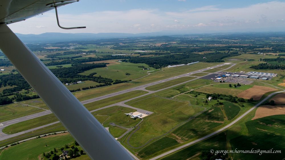
It was about 40 minutes to Sandusky and another 40 or so to Ashland, OH (3G4). This brings me to over 3 hours since the last fueling. Time for a stop. Descending into Ashland it is beginning to feel like a long day already. Obviously I will not make Dunkirk before evening so I might as well stop here for the night.

Descending into Ashland with 3:07 on the E.I.S.


Upon landing I am greeted by a couple who have a Grumman on the field. They open the office for me and bring me a glass of water and offer some cake. Hoping to loose a few pounds now that winter is over, I decline. Carrot cake? My favorite. I will take a piece.

Michael is only about 15 minutes away. As I finish my cake they bring me over to show me their hangar. They have done a bit of work and turned it into a comfortable hangout. Carpet, chairs and refrigerator. All the comforts of home for their plane named Taz.

Michael arrives and is shown some recent engine work

It turns out to be a good decision to have stopped here for the night. By the time we tie down the plane, drive into town for dinner and find a hotel it is getting late. By tomorrow the winds across New York should have died down with the low that lingered over the eastern part of the state moving northeast.

During the night the high pressure over Michigan has moved to the east allowing moisture from the next system to move eastward. The Weather Channel, aviation weather online and finally, stepping outside the door confirmed this with showers visible just to the southwest of our location.

We don't waste any time and head out, stopping at McD for a quick bite to eat. Driving to the airport I receive a text message with a picture of Wilmington, NY with 3 feet of snow. Snow was in the forecast for the mountains of northeast New york but I assumed it was going to be more like a few inches. In less than 2 weeks I will be camping and hiking in that area!

At the field the airport manager came out to greet us and pumped 6 gallons into the plane giving me about 10 gallons for the next leg. (Early on I decided that to keep oil calculations simple by just adding multiples of 3 gallons to the tank)

With cautious priming the engine started and as I taxi out a light rain is beginning to fall. In the air the precipitation is like a curtain to the south of me as I head out on course. In the distance to the north and east the skies are lighter with sunshine at the horizon.


For over an hour Cleveland is visible almost 50 miles in the distance as I first head SSE then ENE rounding the Akron Class C airspace.


Looking ahead along the route to the BSV VOR which at this point is still 30 miles ahead. Note the rain drops on the windshield. Timing for this trip couldn't have worked out better. If we were any earlier or later, weather would have been a big problem.


After rounding the Akron airspace my next stop was Port Meadville, PA (GKJ) for fuel. Again concerns over starting hot are on my mind.

After quite a bit of cranking and waiting, the engine fires and I'm on my way toward my final fuel stop in Dunkirk, NY.


Just west of Dunkirk I head out over Lake Ontario, both to line up a shot of the town, harbor and the airport and also to enter downwind for runway 33. Several other aircraft are already in the pattern and I circle over the lake once before joining the downwind leg to provide adequate spacing.

A beautiful Waco on the ramp.

Another hard start, but I was confident it would. Final leg to Marcellus. On the last half of the leg into Dunkirk it was getting bumpy at altitude and it had me thinking there was some wind sheer over 5,000 feet. Now it was quite bumpy down low too.


Passing Letchworth I got tired of the rough ride and climbed to 6,500' where things finally smoothed out. This gave me a nice view over the Finger Lakes towards home.

Looking east over Canandaigua, Seneca and Cayuga Lakes

Finally home to Marcellus!


About 650 miles and over 12 hours of flying. What a way to spend a holiday weekend!
A great experience, and as always I met many friendly, helpful people along the way.

And, yes, you can fly a Challenger over some serious distance. All you need is the time.
It isn't much faster than driving, but WAY more fun!