Showing posts with label adirondack. Show all posts

Friday, August 18, 2017

Flight to Old Forge

With some beautiful weather after a very wet spring and summer I wanted to take a little adventure in the plane. In the next couple weeks the plane will go in for its annual, I will be finishing up work and retiring, then we will be headed to Logan UT for David and Kelli's wedding. At least through the middle of September, life will be busy.

I considered Rutland, VT or Mt Washington, NH but decided to save those for a later date to camp and do some hiking during the fall foliage season.

With my planes' leisurely 100 mph cruise it is under 45 minutes to Old Forge. From start-up to shutdown about an hour, plus any sightseeing added to that.

The air was cool and perfectly smooth both directions however, haze increasing to the north and east made photography difficult from cruising altitudes of 5,500 going out and 6,500 on the return. It wasn't worth opening the window to take many photos.

There was some fog along the route and on the Fulton Chain of Lakes that I could see in the distance but it was burning off quickly with the morning sun.


This is Middle Settlement Lake. On my birthday a couple weeks back I hiked from Route 28 near the Onieko Lakes to here.

Approaching Old Forge airport. It is visible from quite a distance back as it is the only clearing in the unending forest of the Adirondack Park. Just to the right of this image is the village of Old Forge only a 20 minute walk away.

Turning downwind I spotted a group of kayakers working their way up the Middle Branch Moose River. With all its meandering, it appears you will paddle at least 2 miles for each 1 mile made good!

Parked at Old Forge. There were 5 other planes tied down as well as several in hangars around this developing fly-in community. All the properties around the field have been sold to pilots who will build homes and be able to taxi from the runway to their house.

A short walk into town brings you to Main Street (Rt 28) on the west side of Enchanted Forest/Water Safari. I continued through the town for breakfast at Keyes Pancake house, then to Mountainman Outdoor Supply and onto Thendara.

Kayakers on the Middle Branch Moose River from Rt 28 bridge.

I returned along the Tobie Trail, a paved walking/biking path which follows Rt 28, then turns south to avoid the downtown section and turns back north to cross the bottom of First Lake and back along the road to the airport before heading off to Eagle Bay and Inlet on Fourth Lake.

So often I've said that the flying was the best part of any trip.  Now after 45+ years in the air I've finally gotten to the point where, while I love the air time, I really enjoy exploring new places and talking with all the interesting people I meet.

Mountain Air Painters


Route 28 looking NE from the Middle Branch Moose River towards town


First Lake, park with beach area and Enchanted Forest

Along the way back I just relaxed. Again haze made photography towards the south impossible.

Drivers village, Rts 81 and 481 Syracuse Hancock Airport

Hancock Internation Airport and the Post Office

A couple shots of Onondaga lake and Syracuse


Saturday, November 19, 2016

Flight to OK Slip Falls near Indian Lake

It's mid November and we have been blessed with warmer than normal fall weather. This pattern is about to be broken by a cold front arriving Saturday that already has snow warnings posted for the area.

Friday however, was a beautiful day. Heading to the airport late morning there were warm temperatures, clear skies, light surface winds and a very stable atmosphere. Planes were flying and the radio full of traffic. I think everyone realized we should make the most of this day.

Where to go? I considered heading down to the lower Hudson over the Catskill Mountains, but headwinds on the return would make for a long ride back and the days are now getting quite short. Winds of 15 kts aloft were forecast to be out of the west over western and central NY but turning sharply to blow from the north over the eastern half of the state.

I decided to go northeast towards the High Peaks to take a look at OK Slip Falls. CNY Hiking - OK Slip Falls. Previously located on private land this waterfall has only recently opened up to the public. It is one of the highest falls in the Adirondack park and has been on my list of places to hike, but haven't had a chance yet.

With the GPS coordinates of the falls entered into ForeFlight and after topping off the tanks I was in the air making a circling climb over the airport before heading east over the Syracuse Class C airspaces' 4,400 foot upper bounds. Until a couple months ago my transponder was out of service, so flying through or even over the Class C airspace was not permitted. I would always go under its upper layers or all the way around.


This gave me a rare look at Onondaga Lake and Hancock Airport. Even my workplace at the Syracuse GMF...
Onondaga Lake from the south at 5,500'

Carousel Mall

Syracuse Hancock International Airport

For all my Postal friends, the Syracuse GMF. 
(Sorry you guys had to work today...)

Oneida Lake

Cruising along in perfectly smooth, though not perfectly clear air, I settled back to relax for the hour or so it would take to reach my destination.

The engine rumbled alone happily until about 10 minutes later. Somewhere over the eastern portion of Oneida Lake while scanning the sky for traffic and enjoying the view, I was pulled out of my relaxed state of mind by a sudden and rapid decrease of engine RPM. Quickly looking at oil pressure, which was normal, I advanced the mixture to "full rich", turned on carburetor heat and turned towards the farmland south of the lake.

The engine returned to normal almost instantly. I continued in a gradual turn back towards home base  while checking to insure that it was simply carburetor icing. Eventually I turned back on course except now adding carburetor heat at regular intervals and there were no further problems. Engine issues over the farmland of Central New York is one thing, there are many, many fields to choose from. In the Adirondack Park there is only a choice of forest, wetlands or lakes. 

Griffiss

I thought this was interesting with both the old Griffiss airbase and the Erie canal in one view. Then I realized that the thruway and NY Central rail line was in the picture as well!

Hinkley Reservoir 

A few years back I kayaked around this lake with the CNY Kayak club.

Indian Lake and the High Peaks beyond

Village of Indian Lake with Blue Mountain beyond. Blue Mountain is a great hike. At the top there is a fire tower that gives great views for many miles around.

OK Slip Falls

ForeFlight and my Bad Elf Pro GPS put me right over the falls! A few turns around for some pictures before heading back to Piseco 30 miles back to the southwest. Because of the unforgiving terrain below I stayed at a reasonable altitude. For a closer look I will hike in someday.

Mountains and haze

Heading back into the sun all the shades of blue as the mountains fade away into the hazy air looked worthy of a picture.

45U on the ramp at Piseco

That is a house in the background with a built-in hangar on the airport side


Piseco Airport

All the way back to Marcellus the sun and haze made picture taking near to impossible. The mostly clear air over the mountains where winds aloft were from the north contrasted sharply with the hazy air in the valleys brought in by western winds.

Great late season flight. Three hours round trip.

As I write this Saturday afternoon the cold front is already entering the area dropping temperatures from the 70's a few hours ago to 50 degrees at 4:00 pm. Rain and snow are following right behind.


Tuesday, October 6, 2015

Fall Foliage flight to Old Forge, NY (NK26)

A week ago I was hiking in the High Peaks near Lake Placid. There, the trees were just starting to change. Since then, some cold nights have got the fall colors approaching their peak very fast.

An extra run for fuel put me a little behind getting the plane into the air and cut into my time around Old Forge a little. The flight up in smooth, clear air took just a few minutes over one hour at an easy cruise of 95 mph.


Passing Booneville the green forest began to change to more golden and red. I would guess that peak colors for this area will be within the next week or so.

Approaching Old Forge

Old Forge airport

My 1965 Cessna 150E at Old Forge

Turning from downwind to base leg as I was landing this area of the Moose River filled my windscreen. With the meandering river and cone shaped pine trees it looked like a magical spot for a paddle. After take-off I circled the area hanging out the window with my camera, but couldn't capture the look and feeling that  I had when I saw it while landing.

Just beyond Old Forge on the way to Inlet is a great little hike up Bald Mountain to a refurbished fire tower. It is not a long hike with only a couple steep areas to contend with, but the view from the tower of the Fulton Chain of lakes all the way to Blue Mountain is well worth the effort!

A zoomed in shot of hikers

Moss Lake just north of Eagle Bay has about a half dozen hike in primitive campsites scattered around the lake. A few years back I spent the evening watching a super-moon rise over the hills. 
It was beautiful!

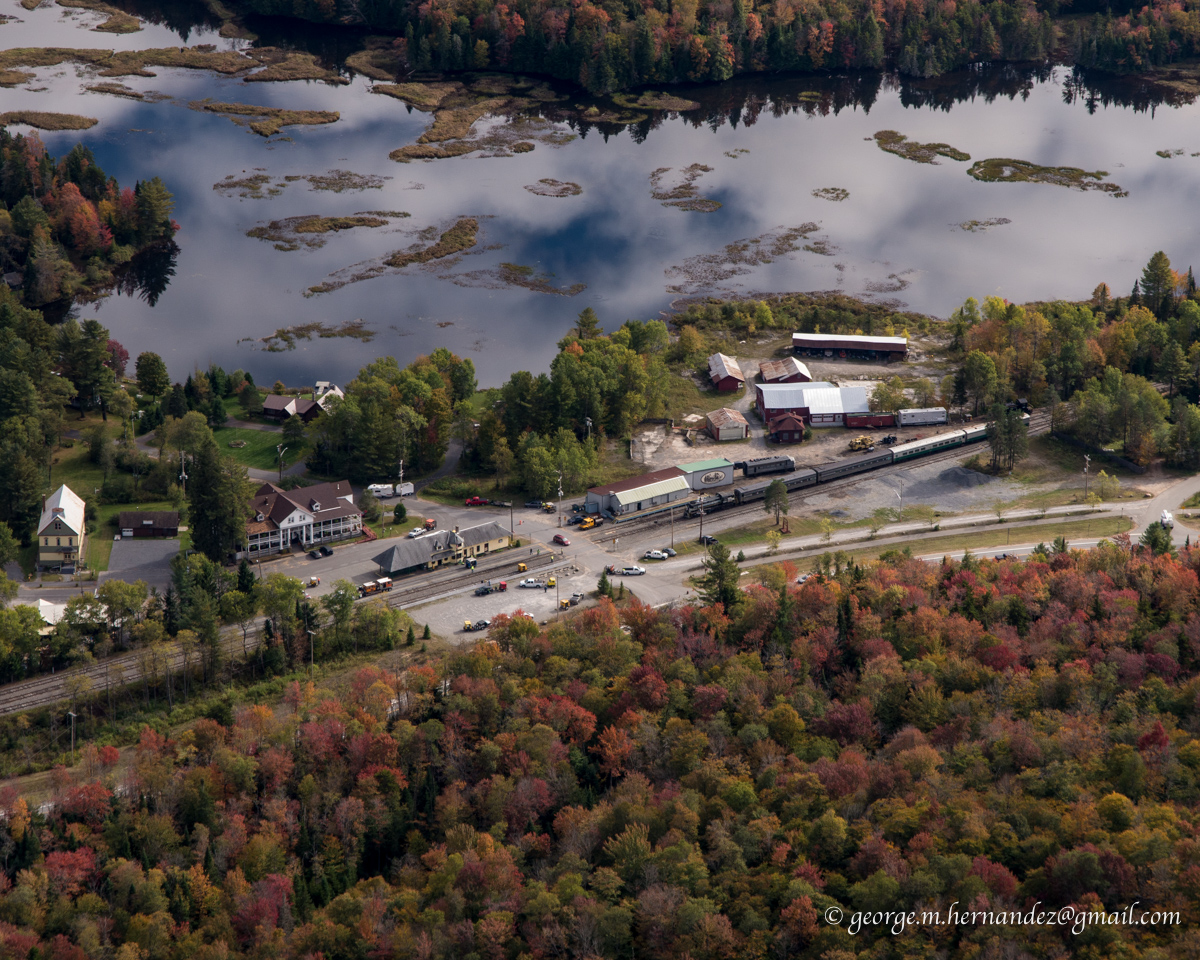
Thendra and the Adirondack Scenic Railway station

Almost back home I pass over the end of Oneida Lake as I skirt around and under the SYR Mode C airspace.

Passing Onondaga Lake I see one lone sailboat from the OYC out on the lake. From the red hull I think this must be Tom in his Flying Scot


Back to Marcellus where trees are still mostly green.

I would like to make another flight up to Old Forge and maybe beyond to Placid in the next week or so and spend more time taking more pictures and exploring some different places along the way.


Saturday, November 9, 2013

Flight to Lake Placid and the High Peaks

I've been wanting to make this flight to see the peaks I've hiked for quite some time but each time weather, usually strong winds has prevented me. On a couple occasions when good weather aligned with my days off I was already in these mountains hiking.

On this day there was high pressure over the northeast and the skies were clear. The only possible problem were winds in the northeast portions of NY, but they were forecast to die off about the time I would arrive.

(click on images for full resolution)
Departing Marcellus just before 10 am I headed NE at 1,600' to remain under the Class C airspace surrounding Syracuse.

My first turn point was Syracuse Suburban Airport (6NK) near Brewerton. A few years back lots of taxpayer money was spent paving and refurbishing this unused field only to have it continue to be unused. Passing 6NK I was out from under the Class C and made an 80 mph cruise climb to 5,500'

Passing north of Camden and Rome marks from the last glacier are visible in the foreground with the large wind farm west of Booneville in the distance.

Mudhole pond and Pine Lakes just SW of Old Forge
Most of the leaves were gone from the trees once I left the lowlands of Central NY, but the endless  undeveloped forest of the Adirondack Park was beautiful none the less. Forest broken only by lakes, creeks, swamps and very rarely, a road.

Old Forge and the Fulton chain of lakes. To the left of center the Old Forge Airport is visible. In the distance just to the right of center is Blue Mountain a great afternoon hike with an unrestricted views from the fire tower on the summit.
Heading into the eastern part of the state skies became a little hazy, though visibilities were still 50+ miles

Approaching the High Peaks, Santanoni Peak in the foreground beyond Moose Pond on the right. Algonquin and Marcy white with snow and ice on the horizon beyond.

Marcy on the left, Skylight closer, Haystack behind. In the distance, Giant.


Hikers atop Marcy in this zoomed in shot

Indian, Algonquin and Wright.

My Cessna at Lake Placid. Whiteface in the background.

I was really surprised to find a Challenger tied out at Lake Placid. This is a single seat version of the two-place I own. Some day I want to fly my Challenger up here and spend a couple days photographing the hills and area where I spend so many of my weekends.

Cessna sizing up the next Challenge.

Whiteface Mountain and the Whiteface Veterans Memorial Highway. My son David and I hiked Esther and Whiteface again a year ago. We first hiked Whiteface almost 20 years ago when he was 6.

After flying over the KOA I frequent when in Placid, I followed Rt 12 to Upper Jay to pick up Rt 9N to Keene and Keene Valley. Marcy Field in the foreground.

From the right: Lower Wolfjaw, Upper Wolfjaw, Armstrong, and Gothics along the Great Range. (I hiked the latter 3 on one 12 hour hike in 2012.) In the distant center is Marcy. These mountains are even more intimidating when flying down low than they are when hiking. The view flying just above the peaks is breathtaking.

I didn't take too many pictures on the way back as the sun and haze made for very low contrast from cruising altitude.

Bald Mountain (Rondaxe) is just northeast of Old Forge. It is an easy under 1 hour hike to the tower for a great view of the lakes


Enchanted Forest - Water Safari in Old Forge.

Onondaga Lake and Syracuse with under 10 minutes to Marcellus.
Total flight time just over 4 hours. A very satisfying ride as we near the end of the season. A few days later as I write this I am already hearing the mountains calling me. Maybe I'll take another hike in the lower hills, before winter settles in and snowshoes are needed.